
Mission Bend ZIP Code Directory Coverage
Mission Bend has no single official Postal Service roster that lists every postal route for the Census-designated place. The local and official research encountered several postal leads, each of which needs an exact-address check. The CDP crosses Harris and Fort Bend Counties, and ZIP boundaries do not follow county lines, Census boundaries, subdivision names, or municipal limits. Treat the entries below as documented postal leads, not a complete address list or a boundary ruling.
| ZIP | Areas Covered | Post Office | Notes |
|---|---|---|---|
| 77082 | Harris-side and east or central Mission Bend addresses | Houston postal label | Mission Bend HOA and community records use it; confirm each address with USPS. |
| 77083 | Core and southern Mission Bend records | Houston postal label | Fort Bend planning material lists Mission Bend under this ZIP; it is not a complete CDP roster. |
| 77407 | Fort Bend-side and Clodine or Grand Vista-area records | Richmond postal label | Use as a Fort Bend-side lead, then verify the parcel and CDP boundary. |
| 77498 | Nearby Four Corners and Sugar Land context | Sugar Land postal label | Edge candidate only; no official source proves all such addresses are inside Mission Bend. |
The 2020 Census boundary map controls the CDP question. USPS controls the postal ZIP returned for an exact address. Neither source substitutes for the other, and a ZIP-only result will include nearby Houston, Richmond, Sugar Land, Four Corners, and other adjacent areas.
Mission Bend Postal Labels
Houston, Richmond, and Sugar Land can all appear as postal wording around Mission Bend. The city field should be kept as returned by USPS or the authoritative county system, not rewritten to Mission Bend. Mission Bend is the community and Census-place label, rather than the postal city assigned to every address. This distinction matters when comparing an owner mailing field, a property situs field, and an address from an association or planning record.
The documented ZIP mismatch is a local research feature, not an error to smooth away. ZIP 77082 appears in Mission Bend HOA and community records under Houston. ZIP 77083 is used in core and southern Mission Bend material. ZIP 77407 appears in Fort Bend-side and Clodine-area records, while 77498 remains an adjacent or edge candidate. The ZIP code directory should retain both the postal result and separate county and CDP checks.
Mission Bend ZIP Code Search Fields
County property systems make a ZIP useful only after the county is known. HCAD's advanced real-property search includes a ZIP field for Harris County property. It also exposes tax year, owner name, legal description, street name, beginning and ending street numbers, key map, map facet, school district, state category, and building-style codes. Owner names can be partial and case-insensitive, while street numbers are not partial. The help guidance also notes nightly refreshes and a short delay for recent changes.
| HCAD field | Search use |
|---|---|
| ZIP | Narrows a Harris County property search after county jurisdiction is confirmed |
| Street and number range | Finds a property when a full address format does not return a result |
| Owner name | Supports a property-interest search, not a present-occupancy claim |
| Legal description | Links a parcel to subdivision, lot, block, or other durable property detail |
| Tax year and map facet | Records the time and geographic context of a returned property record |
Fort Bend CAD and GIS are the right next routes for a Fort Bend property. If the live Fort Bend form does not offer a ZIP filter in the selected tab, use address, city, or subdivision fields and then confirm the returned postal address through USPS. A CAD owner or mailing field identifies an appraisal record, not a confirmed resident.
The HCAD advanced search shows the ZIP, street, owner, legal-description, tax-year, and range filters used for Harris-side Mission Bend property research.
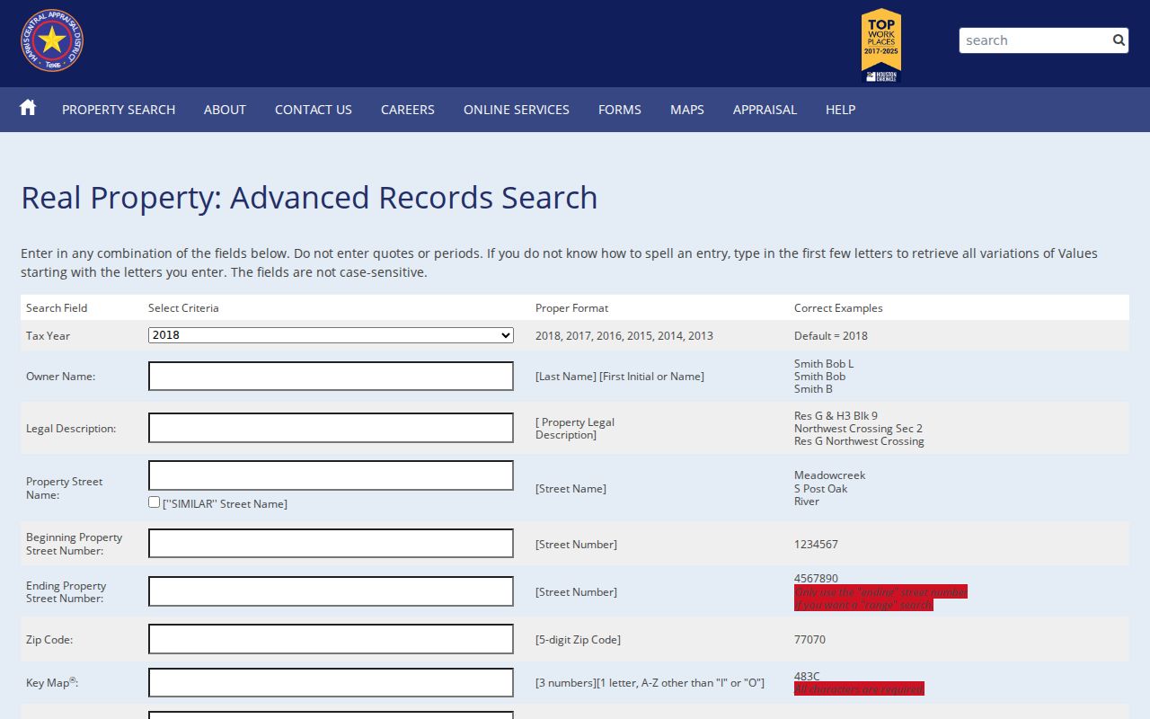
Use a ZIP field to narrow a county property set, then preserve the parcel account and legal description before comparing any other index.
Finding a Mission Bend ZIP Code
Use a ZIP as a location filter, not as a people list. First validate the exact address, then decide which county maintains the parcel record. For Harris-side property, HCAD can apply its ZIP field. For Fort Bend-side property, FBCAD and Fort Bend GIS can confirm address, parcel, subdivision, and county details. The next useful step is the county clerk index if the goal is to understand a recorded property interest or legal description.
- Run the street address through the USPS address lookup and keep the standardized result and date.
- Compare the address against the Census CDP boundary and the Harris or Fort Bend parcel or GIS route.
- Use HCAD's ZIP filter only for confirmed Harris-side property, or use Fort Bend address and subdivision tools for confirmed Fort Bend property.
- Capture the returned account, geographic ID, situs, mailing, tax year, and legal description as record fields rather than a statement of occupancy.
- Use the appropriate county clerk index for a dated instrument or plat when the parcel trail needs a recorded-document check.
Once a ZIP result has narrowed the area to a specific address, the Mission Bend street directory has the fuller address and parcel workflow. ZIP boundaries are too broad to replace a parcel-level search.
Mission Bend Postal Verification
USPS PostalPro lookup offers ZIP Code by Address with street address, city, and state, along with ZIPs by City and State. USPS notes that a returned ZIP does not confirm a person or company at an address. When a company name complicates the search, USPS recommends trying the address without it. The service may normalize city names, so keep the postal wording returned rather than forcing it to a community label.
ZIP+4 is the added routing detail USPS may supply for a standardized address. It refines mail delivery but does not change county jurisdiction, a parcel legal description, or the Census boundary. A ZIP can be a useful first filter; exact postal geography still needs the full normalized address.
The USPS lookup provides the address-to-ZIP and city-to-ZIP modes that support an exact Mission Bend postal check.
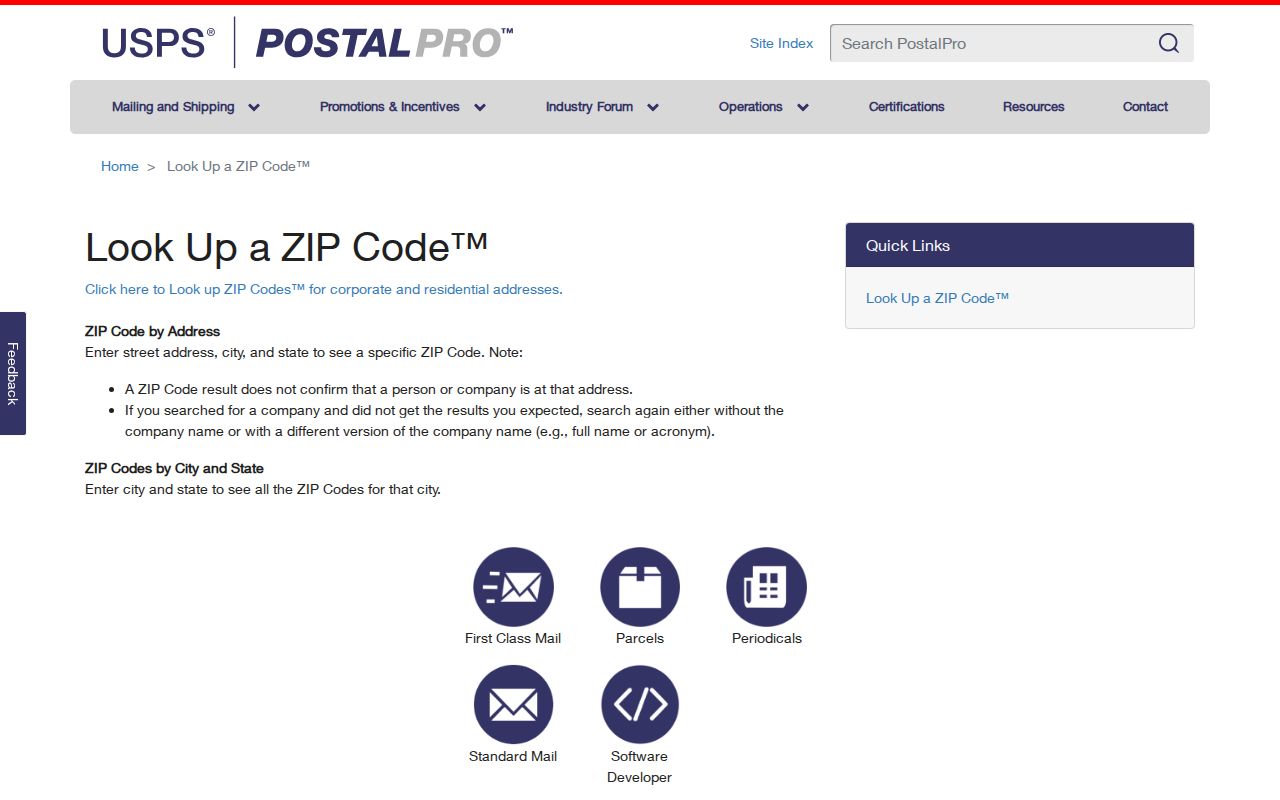
The postal result belongs beside the county and CDP checks, not in place of them.
Note: USPS address standardization can change a city label without changing the property parcel or Mission Bend community context.
Mission Bend Postal Boundaries
ZIP boundaries and Mission Bend boundaries describe different systems. USPS assigns postal delivery geography. The Census map describes a statistical CDP. County CAD and GIS systems identify parcels and county-side records. An HOA, subdivision, school, MUD, or planning-service area can use another boundary altogether. Compare three values when they differ: the USPS postal ZIP, the CAD mailing or situs ZIP, and the ZIP attached to a community or county-planning record.
- ZIP and ZIP+4
- The basic ZIP identifies a postal delivery area; ZIP+4 is an added routing segment returned for a standardized address.
- PO box ZIP
- A ZIP used for post-office-box delivery, which does not by itself identify a street parcel.
- Unique ZIP
- A ZIP assigned to one organization or delivery destination, not a general neighborhood boundary.
- Carrier route
- A mail-delivery grouping within postal operations, not a county, Census, or parcel boundary.
There is no official research support for a Mission Bend ZIP realignment date. Dated USPS standardization, a county address-verification record, a subdivision plat, appraisal snapshots, and GIS updates are the proper evidence for a suspected change.
Mission Bend ZIP County Check
The county split gives a local postal search an extra check that many communities do not need. A known ZIP can still cover land on the Harris or Fort Bend side. Start with the Census boundary, then use Harris County GIS or Fort Bend Interactive Public Mapping to inspect the parcel and public layers. Compare the mapped point with the CAD situs, mailing field, subdivision, and legal description.
Fort Bend mapping includes address points, parcels, subdivisions, boundaries, flood, school, public-safety, transportation, parks, water-district, and MUD layers. Harris GIS provides a map and address locator built from StarMap roads and CenterPoint address data. A map match can help identify an address point, but it is not the same thing as a recorded legal description. If an address does not match, use lot and block, subdivision section, replat, abstract or tract, and instrument number.
Mission Bend ZIP Directory Limits
The strongest local rule is simple: several ZIPs can serve one community, and one ZIP can serve several communities. A complete nationwide-style list is not supported here because no official USPS all-ZIP roster for the Mission Bend CDP was found. Keep that gap visible and verify every included address. The documented set supports a transparent search route, but it does not authorize a claim that every address in 77082, 77083, 77407, or 77498 is in Mission Bend.
For a careful record note, retain the county, CDP boundary status, parcel ID, postal city as returned, ZIP, source URL, and lookup date. Do not use a broad ZIP search to infer who lives at an address or to work around a confidential record. Property and voter portals suppress some information by law, and those privacy limits remain in place even when the postal geography is clear.