
Trace a Mission Bend Street
A Mission Bend street can pass through a Census-designated place that is split between Harris and Fort Bend Counties. It has no city clerk or one municipal property system. First normalize the address with the USPS ZIP Code lookup, then use the county parcel map to establish the county side. The postal city returned for an address does not prove county, CDP membership, or title. A good street directory record keeps those questions separate.
Start with the address, not a list of names. CAD identifies an assessed property interest and displays parcel attributes. GIS supplies the geometry and public layers. The county clerk records the conveyance trail. A voter result, when one is lawfully available, is limited to the public registration information displayed by its own system. Each is a different kind of evidence.
- Enter the standardized address in the matching county CAD system and save the account or geographic identifier, tax year, property address, and legal description.
- Open the matching GIS viewer, confirm the parcel location, and note the county, subdivision section, lot or block, and relevant boundary layer.
- Use the parcel identifiers to search the county clerk index for deeds, plats, corrections, easements, or releases that explain the address.
- Use the applicable county voter route only for the limited public status, precinct, district, or polling information it actually returns.
- For a dated address reference, compare a library or directory source only after the parcel and street history are stable.
That order keeps an owner-of-record, mailing recipient, and current presence from being collapsed into one claim. It also gives a repeatable path when a street name, postal label, or subdivision name changes.
Separate Mission Bend County Routes
Mission Bend’s county split is the first street-search decision. On the Harris side, use HCAD, Harris GIS, and the Harris County Clerk real-property index. On the Fort Bend side, use FBCAD, Fort Bend Interactive Public Mapping, and the Fort Bend County Clerk Official Public Records route. A subdivision certificate or legal description can point to sections recorded in both counties, so the same grantor, grantee, lot, block, or association name may need a second county search.
The 2020 Census boundary map is useful for the CDP boundary, but it is not a parcel title map. Use county GIS and CAD for the exact parcel. This distinction matters when a Houston, Richmond, or Sugar Land postal label appears near the community edge.
Search Mission Bend Street Fields
Use fields that remain useful when a displayed address is incomplete or standardized differently. Fort Bend CAD offers Owner, Address, ID, and Advanced routes. Its advanced fields include street number and name, Quick Ref ID, subdivision, geographic ID, property type, tax year, and neighborhood. HCAD’s advanced search includes street name, beginning and ending street numbers, owner name, legal description, ZIP, key map, map facet, school district, and tax year.
| Mission Bend street field | County system | How to use it |
|---|---|---|
| Street number and name | FBCAD Address or Advanced | Simplify the address when needed, then compare the returned situs and legal description. |
| Quick Ref ID or geographic ID | FBCAD | Use the durable parcel key for a repeat check and GIS comparison. |
| Street name and number range | HCAD advanced search | Test an address range or alternate street spelling; partial street numbers are not accepted. |
| Legal description, map facet, or ZIP | HCAD advanced search | Use these after the county is known to narrow an address-based street search. |
HCAD allows partial, case-insensitive owner names and advises trying address variants. Its data refreshes nightly, and a recent change can take a short time to appear. FBCAD says its Quick Ref ID is the fastest route when it is known. Neither CAD result proves physical presence at the property.
The HCAD advanced-property search illustrates the Harris-side fields used to narrow a Mission Bend street by address, range, ZIP, legal description, or map facet.
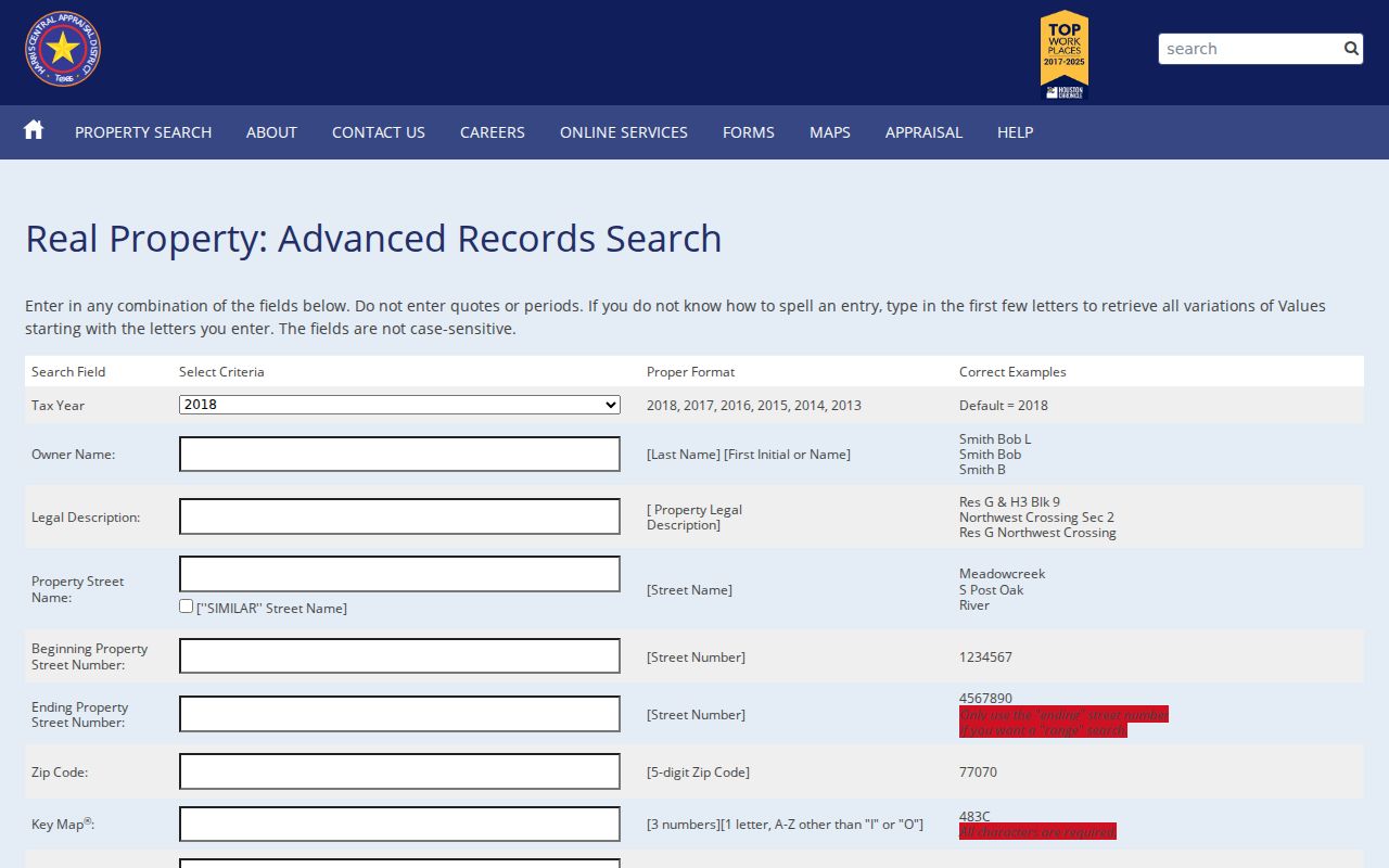
Those fields are search inputs, not evidence of occupancy. Save the tax year and account information before moving to the map or recorded instrument.
Map a Mission Bend Street
Fort Bend Interactive Public Mapping supports pan, zoom, a magnifying-glass search, and layers for address points, parcels, subdivisions, boundaries, flood, schools, public safety, transportation, parks, water districts, and MUDs. Harris GIS provides a map and address locator built from StarMap roads and CenterPoint address data. Select the layer first, then record what that layer actually represents.
For a street directory, the safest unit is the parcel. Capture the account or geographic ID, street, county, subdivision section, lot or block, and lookup date. If a parcel touches a road, drainage reserve, school, park, MUD tract, floodplain, or vacant tract, label the public land use rather than assuming a household on that side.
- Parcel
- A mapped unit of land with a county account or geographic identifier.
- Situs address
- The property location shown in CAD, which can differ from an owner mailing address.
- Plat
- A recorded subdivision map that can tie a street address to a lot, block, and section.
- Criss-cross directory
- A historical address-organized directory, when a collection provides that format.
Use a recorded plat, replat, or legal description to settle a map conflict. A GIS point is valuable for location and adjacent public layers, but it does not replace a recorded legal description.
Mission Bend Address Record Routes
A Mission Bend street directory is built from address-keyed sources with different keepers and limits. Start with the county side, then follow the record that answers the narrow question. Property data can identify a recorded interest and parcel attributes. Clerk data can establish recording events. Voter systems can show only their limited public display. There is no official all-street directory or complete Mission Bend address-history table in the inspected sources.
| Address-keyed source | Mission Bend record keeper | Public result | Access path |
|---|---|---|---|
| Property and assessment roll | HCAD or FBCAD | Owner-of-record, mailing and situs fields, legal description, values, and taxing units | County CAD search |
| Parcel and public-service map | Harris GIS or Fort Bend GIS | Parcel geometry, address points, subdivision, boundary, and public layers | County map viewer |
| Recorded real property | Harris County Clerk or Fort Bend County Clerk | Deeds, plats, liens, easements, and recording references | Online index, counter, or copy route |
| Voter registration route | Harris or Fort Bend election system | Only the status, precinct, district, or polling details the official system shows | County lookup, then statewide route if needed |
| Address verification | Fort Bend GIS and CenterPoint coordination | Administrative verification for a new or changed address | Physical Address Verification Form |
Use the same street spelling, county, and lookup date across the row set. A parcel identifier ties CAD to the deed search more reliably than a street name alone. The Texas SOS statewide route can be a cross-county check after the county is known, but it does not turn voter data into a household census.
Note: County CAD, GIS, clerk, and voter results establish different roles, so record the source and date beside every Mission Bend street result.
Follow Mission Bend Deed Links
For the Fort Bend side, the County Clerk Official Public Records route leads to real-estate index searching by party, grantor, grantee, date filed, instrument number, or document type. The instructions use LASTNAME FIRSTNAME for party names. A VIEW link opens a watermarked image; clean copies are placed in a shopping basket. Plain copies are listed at $1 per page, while certified copies are listed at $1 per page plus $5 certification.
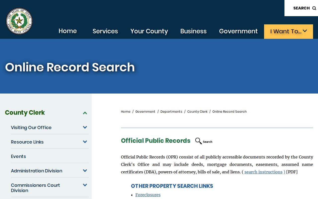
Use the screenshot as a route marker, then save the instrument number and legal description from the actual result. A deed is a conveyance record. A lien release, assignment, correction, easement, or plat can explain an address or title change without establishing a new occupant.
The Harris County Clerk Real Property index is the source shown in this Harris-side street-record image.
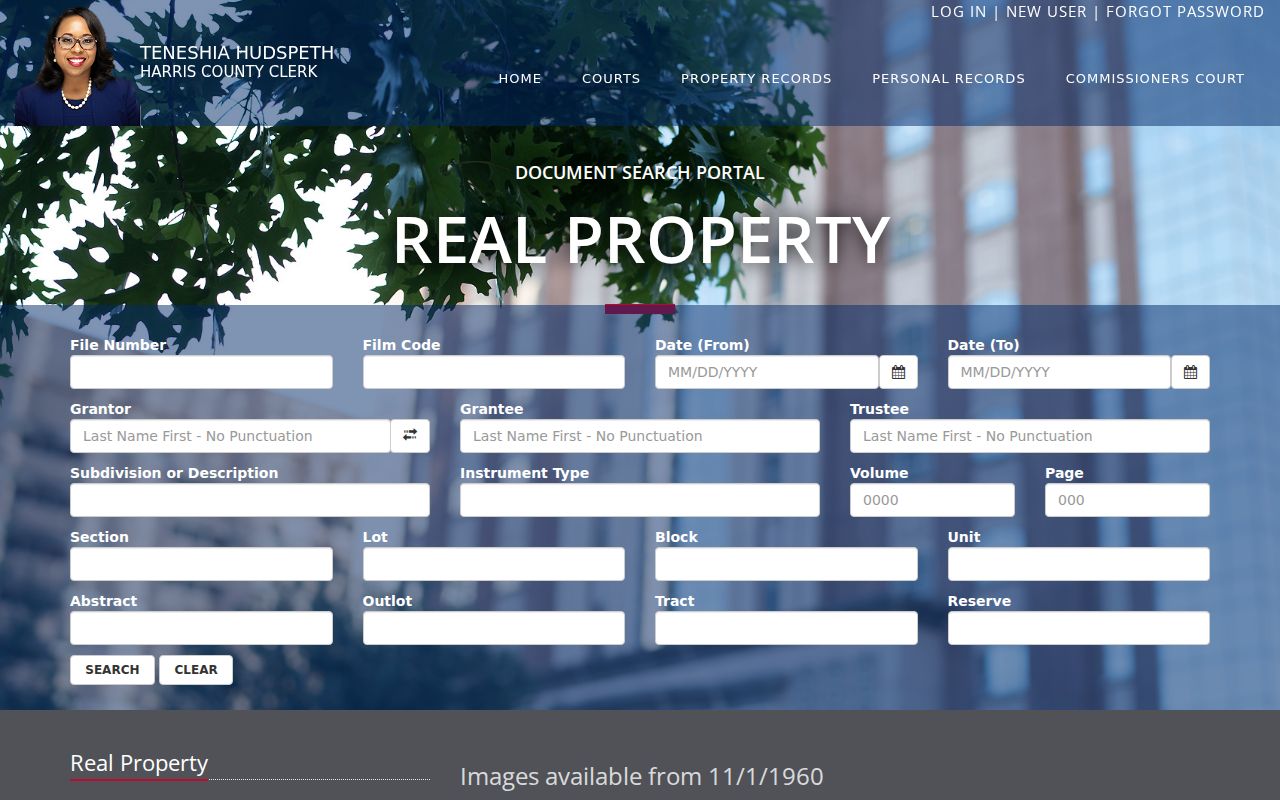
The index supports file number, film code, recording dates, grantor, grantee, trustee, subdivision or description, instrument type, volume or page, section, lot, block, unit, abstract, outlot, tract, and reserve. Images in the inspected portal begin November 1, 1960, and recent recordings can take one to two business days to appear. The portal says it is not the official repository, so use the clerk’s copy-order or in-person route when the image is absent or an official copy is needed.
Check Mission Bend Street Labels
Mission Bend records encounter Houston labels with ZIPs 77082 and 77083, Richmond 77407 on the Fort Bend side, and 77498 as an adjacent or edge candidate. Those labels are routing clues. The Census map governs CDP geography, while USPS validates the postal ZIP for a specific address. ZIP boundaries do not track county lines, subdivision names, or Census place boundaries.
Compare the USPS return with the CAD situs and mailing ZIP and with any ZIP used in an HOA or county-planning record. A mismatch can reflect a postal convention, an owner mailing address elsewhere, a parcel at a county boundary, or stale data. For Harris property, the HCAD ZIP field is useful only after Harris County is confirmed. Fort Bend work should use its address, city, subdivision, CAD, and GIS routes, then confirm the postal form through USPS.
When the street address is missing, try the older street spelling, subdivision section, lot or block, plat reference, abstract or tract, county, and recording instrument. No official Mission Bend-specific street-renumbering list was located. A suspected change needs a plat, replat, successive CAD record, or county address-verification evidence.
Use Mission Bend Voter Boundaries
The Harris County voter search has Current Registrations and Pending Registrations tabs with a criterion selector and text field. Fort Bend uses a separate voter inquiry with a search-method selector, VUID, first and last name, date of birth, and CAPTCHA. Use the county system after establishing the parcel county; the Texas SOS voter lookup is the statewide route for a cross-county check.
Texas voter portals suppress sensitive identifiers and protected addresses. A result should be limited to the status, precinct, district, or polling information that the official system actually displays. A failed CAPTCHA or an unmatched response is not proof that a person is unregistered. Do not infer political affiliation, voting behavior, or household membership from a registration route.
Note: A public voter result is a time-bound registration record, not confirmation that a person currently lives on a Mission Bend street.
Mission Bend Street Privacy Limits
The street directory can identify source roles, not a complete roster of people at an address. Owner, mailing, situs, deed grantee, voter registrant, and historical directory entry are not interchangeable. Texas voter confidentiality can suppress a residence or substitute a mailing address. Texas Tax Code protections can restrict qualifying residential appraisal information, and appraisal systems restrict selected residential images and details.
Protected addresses, juvenile or sealed material, vehicle data, private account information, and sensitive identifiers remain outside a lawful street search. If a portal shows a confidentiality warning or a restricted owner or situs field, keep only the public access limitation and do not use nearby records to work around it.
Keep Mission Bend Street Notes
A reproducible result records the selected parcel, county, map date, active layers, street variant, source URL, tax year, legal-description fields, and any ambiguity. If GIS shows multiple address points or a blank parcel, use the CAD account or geographic ID and the recorded plat as the bridge. Do not choose the closest name by visual proximity.
For a missing document, send a written request to the custodian that holds it under the Texas Public Information Act. Describe the county, record type, date range, address or parcel ID, and instrument number where known. Ask for nonexempt electronic copies and preserve any clarification, estimate, redaction explanation, and response.
Mission Bend Street History Gaps
Mission Bend was established by about 1980, so its useful street trail often begins with subdivision-era plats, appraisal systems, HOA declarations, and modern GIS rather than an old municipal directory. Harris real-property material has a difficult 1955 to 1960 transition, while its archive plan identifies ongoing historical indexing work. A missing image in the current portal is not proof that a recording or property event never occurred.
For an older address reference, a Mission Bend city-directory collection search can provide regional Houston context, but it should not substitute for a parcel match. Houston directory entries identify residents or contacts, not necessarily owners, and Mission Bend postdates most early volumes. Keep the dated source, geographic scope, and legal parcel evidence together.